D1 · Publication Volume 17
Why Build a Geological Model?
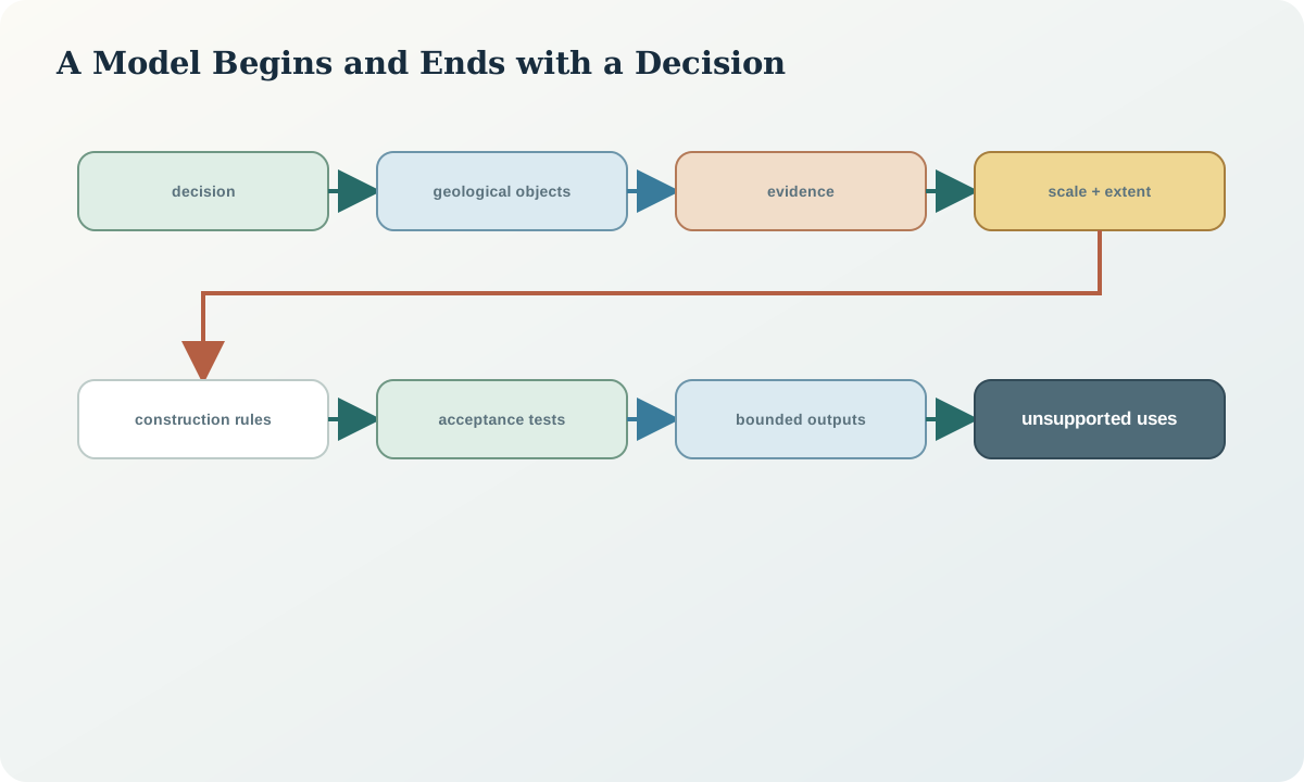
decision purpose, scale, model type and users
Learning objectives
By the end of this lesson, the learner should be able to define a model in terms of its decision purpose, target volume, geological objects, users and acceptance limits; separate a conceptual geological model from its numerical representation; choose resolution from the smallest decision-relevant feature rather than display preference; and explain why one model cannot be assumed fit for every downstream use.
The lesson treats purpose as the first modelling control. Without it, data are added because they exist, surfaces are smoothed because they look untidy and detail is increased without a corresponding evidence requirement. A purpose statement creates a testable boundary around the work.
Decision purpose and model questions
A useful purpose statement names an action and a geological uncertainty. “Build a 3D model” is not a purpose. “Test whether the target horizon could continue across the central fault within the planned drilling window” is closer, because it identifies a hypothesis, a structure, an extent and a future decision. Other purposes include visualising a regional framework, defining materials for a flow model, planning additional observations, estimating enclosed volume or communicating alternative structural interpretations.
Translate the purpose into model questions. Which contacts need positions? Which units need volumes? Must faults carry displacement, or are they only barriers? Is present-day geometry enough, or must event order be represented? Which outputs will be queried numerically? A decision that depends on connectivity requires topology; a decision that depends on distance to a contact requires spatial uncertainty; a communication-only view may tolerate simplified geometry that would be unacceptable for calculation.
Conceptual, structural and property models
A conceptual model is a set of geological ideas and relationships: stratigraphic order, event sequence, fault style, likely continuity and competing explanations. A structural model gives those ideas geometry through contacts, surfaces, faults and volumes. A property model assigns continuous or categorical attributes within that framework. Confusing the layers causes hidden assumptions. A property interpolation cannot repair a wrong structural partition, and a visually coherent structural model does not prove the assigned properties are stationary within its domains.
Record these model layers separately. Each should have its own inputs, parameters, uncertainty and validation. If a downstream process requires hydraulic units, it may combine lithologies differently from a mineralisation model. The same evidence can support more than one purposeful partition without implying that one universal set of domains exists.
Extent, scale and resolution
Define a model bounding volume with a horizontal coordinate reference system, vertical datum, units and explicit inclusion boundary. Then define the scale of the decision and the minimum feature that must be represented. Resolution is not simply cell size or triangle spacing. It includes sampling density, section spacing, surface curvature, allowed feature thickness, output discretisation and the precision of input coordinates.
A model should not imply resolution finer than its constraints. If contacts are known to tens of metres, a surface sampled every metre may be computationally convenient but is not one-metre evidence. Conversely, an output grid too coarse to preserve a narrow fault sliver can change connectivity. Conduct sensitivity tests by varying representation resolution while holding geological rules constant, and distinguish numerical convergence from geological correctness.
Users, interfaces and derived products
Identify users by decisions, not job titles or institutions. One user may need editable interpretation surfaces; another may need a stable categorical grid; another may need sections with confidence; another may need only a model extent and source register. Define which object is authoritative and which outputs are derivatives. A rendered scene, exported mesh and block coding should all point back to the adopted model version.
Interfaces create risk. Coordinate transformations, clipping, resampling, mesh decimation and categorical remapping can change geometry or meaning. Specify units, reference systems, null semantics, boundary ownership and precision at each interface. If a downstream consumer requires mutually exclusive domains, the delivery acceptance test must include complete coverage and no overlaps.
Fitness, acceptance and stopping rules
Acceptance criteria turn purpose into review. Criteria may include maximum contact residual at high-confidence observations, permitted closure error, required topology, minimum retained feature thickness, scenario coverage, validation independence and documented unsupported areas. Criteria should be set before reviewing the preferred result so they do not move to accommodate it.
Stopping is also purpose-dependent. Modelling can stop when the decision is insensitive to remaining uncertainty, when new detail would be unsupported, or when a stated data gap prevents further discrimination. A stopping rule is not a claim that the geology is complete. It records why the current evidence package is sufficient—or insufficient—for the bounded use.
Synthetic worked example
The fictional study volume contains a folded horizon cut by a steep fault. The decision is whether one additional drillhole should test the northern continuation of the horizon. The initial request asks for a “high-resolution 3D model.” Reframing produces a better contract: represent the horizon and fault within a 600\,\mathrm{m}-wide decision corridor; preserve two plausible fault-offset scenarios; show distance to the nearest direct constraint; and identify locations where the scenarios predict different intersections.
The model does not need detailed weathering, every thin unit or a property estimate. Its acceptance tests are: all accepted contacts are within their positional tolerance; the fault divides the horizon consistently; each scenario creates closed target volumes; the planned hole crosses the scenario-divergence zone; and extrapolation beyond the corridor is visibly masked. The reframed model is smaller but more useful.
Practice and review checklist
For a model request available to you, write a one-page contract. Include the decision, hypotheses, extent, reference systems, model objects, smallest decision-relevant feature, authoritative outputs and acceptance criteria. Then answer:
- Which requested detail has no effect on the decision?
- Which decision requires topology rather than only visual geometry?
- Which derived product could lose a narrow or discontinuous feature?
- Where will the model necessarily extrapolate?
- What result would make further modelling inappropriate without new evidence?
Review the contract with someone who did not draft it. If they cannot tell what the model is allowed to support, the purpose is not yet operational.
Decision record and integration
Store the purpose record with the model version, not in a detached presentation. Give each purpose statement an identifier and link acceptance tests to executable or reviewable evidence. If the use changes, create a new purpose revision and reassess fitness rather than silently reusing the old model.
The handover to data preparation is a constraint specification: required objects, evidence types, tolerances, domain concepts and exclusions. This prevents the next stage from treating every available dataset as equally relevant or equally reliable.
Sources
- An inventory of three-dimensional geologic models, distinguishes model types, purposes, spatial extents and published attributes.
- Techniques for improved geologic modeling, discusses objective selection and controls on surface construction.
- Three-dimensional geologic maps and visualization, describes surfaces, interaction rules, volumes and uncertainty.
- GeoSciML 4.1, separates geological features, observations and exchange semantics.