C6 · Publication Volume 16
Geotechnical and Hydrogeological Logging
discontinuities, strength, water and domain relevance
Learning objectives
This lesson extends drillhole observation beyond lithological naming. The learner should be able to record discontinuity condition, material strength indicators, fracture frequency, weathering, core condition and water observations; distinguish measurement from classification; align fields with a decision; and prevent isolated core observations from being overextended into rock-mass or groundwater claims.
Geotechnical and hydrogeological logs share depth with geological logs but answer different questions. They should be linked, not collapsed. A geological contact may coincide with a change in strength or water behaviour, but coincidence must be observed rather than imposed.
Discontinuities and material condition
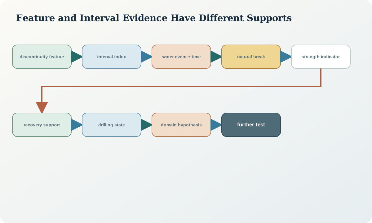
For each relevant discontinuity or interval, record orientation support, spacing or frequency, roughness, waviness, aperture, infill, coating, weathering, persistence visible in core, termination and break-origin confidence. Use defined scales and state observation length. A core tray cannot reveal field-scale persistence that extends beyond the recovered cylinder.
Distinguish intact material properties from discontinuity-controlled rock-mass behaviour. A strong core piece can belong to a weak rock mass with continuous unfavourable joints; weak intact material can occur in a relatively massive interval. Descriptive strength tests are index observations with operator and moisture dependence, not substitutes for calibrated laboratory tests where those are required.
Record drilling- and handling-induced disturbance. Grinding, polishing, stress relief, slaking and breakage can mimic natural condition. Time between recovery and logging matters for moisture-sensitive materials. Photographs and condition timestamps help preserve the context.
Interval indices and classification inputs
Interval measures may include recovery, rock-quality designation, fracture count, total core recovery, solid-core recovery and weathering proportions. Every metric needs a denominator, minimum piece rule, interval support and break classification. Do not compare values computed with different conventions as if they were the same variable.
Rock-mass classification systems combine several inputs and are purpose dependent. Store the observed inputs and the specific calculation version rather than only a class label. A classification derived for one engineering context should not be transferred automatically to another.
Depth resolution matters. A three-metre run average can conceal a thin crushed seam. Preserve feature-level records and derive reporting intervals by a documented rule. Do not subdivide a measure below the support on which it was observed.
Water and borehole observations
Hydrogeological observations can include water strike, return change, inflow or loss, standing water level, pressure response, temperature, conductivity, turbidity, drilling-fluid properties and recovery after disturbance. Each needs time, hole condition, drilling state, measurement method and reference elevation or depth. A water level while circulating is not a static groundwater level.
Drilling alters the system through pressure, fluid addition, casing, air lifting, development and open-hole connection between units. Record these activities so later users can distinguish formation response from operational effect. “Water at 80 m” is ambiguous: it may refer to measured depth of a strike, water level below collar or interpreted aquifer depth.
Do not infer hydraulic conductivity from fracture count alone. Connectivity, aperture, infill, stress, scale and boundary conditions matter. Likewise, a lost-return interval is evidence of fluid behaviour under drilling conditions, not a complete aquifer test.
Uncertainty and quality controls
Quality controls begin with purpose: slope, tunnel, foundation, groundwater, environmental or geological-model decisions need different observations. Define mandatory fields, methods, frequency, units and missing-value states. Calibrate descriptive roles using reference pieces and duplicate intervals.
Check that discontinuity counts exclude mechanical breaks under the declared rule, strength descriptors include condition, water observations have time and drilling state, and derived classes can be recalculated from source fields. Plot indices beside recovery, lithology, weathering and drilling events. Apparent changes can be caused by method or diameter transitions.
Uncertainty should identify sampling bias. The core cylinder samples a tiny volume and intersects discontinuities according to orientation. Poor recovery selectively removes weak material. Open-hole water observations integrate an uncertain contributing interval. Report those limitations with any domain interpretation.
Synthetic worked example
A synthetic interval from 96 to 102\,\mathrm m has 97% recovery and 68% rock-quality designation. Most pieces are strong under a defined field index, but a 0.12\,\mathrm m clay-filled discontinuity at 99.4\,\mathrm m is smooth, low angle to the core and surrounded by softened material. A return-loss event begins at the same depth, followed by a delayed water-level recovery after drilling stops.
The interval average alone suggests moderate fracture condition. The feature-level record identifies a potentially important weak and transmissive plane. The evidence does not establish field persistence or hydraulic conductivity. The review recommends an oriented check where confidence permits, a purpose-designed hydraulic test and preservation of material for laboratory work.
If the thin seam were averaged into a three-metre class, the decision-relevant feature would vanish. If the return loss were called an aquifer without time and operational context, the inference would exceed the observation.
Practice and review checklist
- Are intact material and discontinuity observations separate?
- Are natural, drilling and handling breaks distinguished?
- Do interval metrics retain denominators and calculation rules?
- Are thin critical features preserved below summary-interval scale?
- Can any classification be regenerated from source inputs?
- Do water records include time, depth reference and drilling state?
- Are fluid additions, casing and circulation changes linked by depth and time?
- Are orientation and recovery biases reported?
- Does the log match the engineering or hydrogeological decision?
- Are further tests framed as hypothesis tests rather than confirmation?
Return a log that supplies a class without its observations, or a groundwater conclusion without measurement conditions, for correction.
Decision implications and integration
Geotechnical and hydrogeological logs support domain hypotheses, test selection and risk identification. They do not by themselves design an excavation, predict inflow or establish field-scale properties. State the scale and purpose for which each observation is adequate.
Integrate feature, interval and time-series tables through hole identity, depth and time. Keep geological units, rock-condition domains and hydraulic interpretations as related but independently versioned objects. A reviewer should be able to ask whether a proposed domain boundary persists after excluding low-recovery intervals or operationally disturbed water observations.
Sources
- Engineering geology field manual, provides public guidance on discontinuities, material description, groundwater and core logging.
- Geotechnical investigations manual, relates drilling, sampling, core records and subsurface engineering investigations.
- Standardized method for logging drill core, supplies reproducible descriptive and photographic context for core condition.
- Geoscience information model, supports interoperable borehole, specimen, observation and result records.