E1 · Publication Volume 23
GIS Vector and Raster Foundations
geometry, topology, resolution, NoData and alignment
Learning objectives
distinguish vector geometry from raster cells and sampled support; preserve topology, dimensionality and NoData meaning; design a target raster grid; select resampling by variable type; and validate cross-layer alignment without treating display overlap as proof.
The objective is transferable reasoning, not operation of a named product or performance of regulated survey work. Every real decision must use current applicable requirements, authorised control and competent review.
Decision context
The decision is which spatial representation and grid support preserve the phenomenon and analysis. Points, lines and polygons model discrete geometry and relationships. Rasters store values over regular cells whose location, extent, resolution and alignment are part of the data. Converting between them changes support and can change meaning even when the CRS remains constant.
Before processing, declare whether values are categorical, continuous, counts, proportions, elevations, directions or identifiers; whether a cell value represents centre, area, dominant class or aggregate; which topology matters; and what information loss is acceptable. File format does not answer these scientific questions.
Core concept
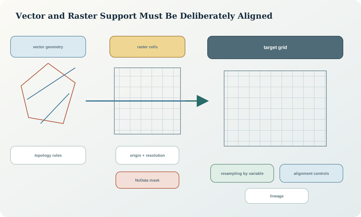
Vector validity concerns coordinate sequences, closure, ring orientation where required, self-intersection, duplicate vertices, multipart structure and topology among features. A geometrically valid polygon can still be geologically wrong if contacts overlap, gaps are forbidden or attribution contradicts adjacency. Topology rules follow the data model and decision.
A raster grid is defined by CRS, affine transform or origin, pixel dimensions, width, height and pixel interpretation. Two rasters can share CRS and resolution but remain half a cell apart. NoData is absence or invalid support, not zero. Masks, coverage and quality layers should be explicit rather than encoded through arbitrary values.
Reference frames and metadata
Spatial metadata includes horizontal and vertical CRS, axis and units, geometry dimension, bounding box, resolution or coordinate precision, raster origin and alignment, pixel-is-area or pixel-is-point convention where applicable, NoData value and mask semantics, topology rules, resampling history, scale or support, acquisition time and lineage.
A raster's CRS identifier does not fully describe its grid. Preserve the exact transform and dimensions. A vector layer's CRS does not describe coordinate rounding or snapping tolerance. Precision reduction is an operation with potential topological consequences and must be recorded.
Quantitative reasoning
For a north-up raster, cell centre coordinates can be expressed as x=x_0+(c+0.5)\Delta x and y=y_0+(r+0.5)\Delta y under a declared corner-origin convention. Alignment requires target origins to differ by integer multiples of cell size after transformation. Rotated grids require the full affine matrix rather than two scalar resolutions.
Nearest-neighbour resampling selects a source value and is often appropriate for classes; bilinear and cubic methods interpolate numeric fields but can create values not observed; area-weighted aggregation is needed for conserved extensive quantities. The method must match the variable, scale change and decision.
Evidence and uncertainty
Evidence includes original geometry, raster transform, masks, schema, topology rules, acquisition footprint, resolution, processing code, resampling choice, before-and-after checksums and independent control features. Screen pixels and map tiles are display products, not original analytical support.
Uncertainty comes from source location, classification, sampling support, transformation, interpolation, edge effects, mixed cells and scale mismatch. Higher display resolution does not add information. Repeated resampling can smooth, sharpen or shift patterns and should be avoided through a planned target grid.
Transformation and control
The controlled workflow verifies CRS and vertical reference, profiles geometry and grid, defines one target grid, transforms from immutable sources, applies variable-appropriate resampling, preserves masks, validates vector topology, checks raster alignment by transform and cell indices, compares independent controls and records the operation.
Stop when NoData semantics are unknown, categorical codes lack definitions, source and target vertical references differ, the target grid is chosen from a display viewport, topology repair would alter scientific interpretation or repeated resampling history cannot be reconstructed.
Interfaces and data
The vector contract includes geometry type, dimension, CRS, precision, topology profile, feature identifier, null geometry rules and attribute vocabulary. The raster contract includes CRS, transform, dimensions, data type, scale and offset, band meaning, unit, NoData and mask, pixel interpretation, resampling eligibility and quality layers.
Spatial indexes accelerate queries but do not validate geometry or CRS. Tiling and pyramids create derived supports for delivery; analytical calculations should state which resolution was used and avoid reading a lower-resolution overview by accident.
Integration checkpoint
The checkpoint passes when two rasters are proven aligned from their transforms and cell-index tests, not just visually; vector topology passes declared domain rules; NoData remains distinguishable from zero; and resampling is justified by variable semantics.
A cross-section through the data can reveal half-cell shifts, edge extrapolation and smoothing. Compare original and derived values at controls and across boundaries, not only global summary statistics.
Synthetic worked example
A synthetic terrain raster and categorical geology raster share a projected CRS and 10 m cell size, but their origins differ by 5 m. A fault vector appears aligned at one zoom level. The learner defines a target grid, resamples terrain with an interpolating method and geology with nearest neighbour, preserves masks and tests control intersections.
A small category disappears at coarser support, so the learner records information loss rather than claiming exact preservation. All geometries and values are synthetic.
Practice task
Audit two synthetic rasters and three vector layers. Build a grid and topology profile, define a common target grid, choose resampling per band, test NoData, run at least four topology rules and produce a before-and-after alignment table at independent controls.
Submit transforms, masks, operation manifest, residual or cell-index tests, topology exceptions and an information-loss statement.
Common failure modes
The following failures are treated as evidence or process defects, not cosmetic issues:
- assuming equal CRS and resolution means aligned grids.
- using zero as NoData.
- resampling categories with an averaging method.
- reprojecting the same raster repeatedly.
- repairing topology without domain rules.
- using display tiles for analysis.
- ignoring vertical reference in terrain data.
For each failure, preserve the original evidence, identify its downstream reach, define a discriminating test and record whether the case is corrected, rejected or still unresolved.
Review questions
- How do raster cells differ from point samples?
- What metadata defines a raster grid beyond its CRS?
- Why does variable type govern resampling?
- When can a valid polygon still violate geological topology?
- How can a half-cell shift be detected numerically?
Answer with definitions, evidence, a calculation or test where relevant, and the condition that would reverse the conclusion. A product screenshot or unexplained code is not an answer.
Assessment artefact
The assessment artefact is a vector-raster integration package. It contains representation semantics, target-grid contract, transforms, masks, resampling decisions, topology profile, independent alignment tests, loss assessment, lineage and delivery metadata. It proves reproducible integration for the synthetic task, not improved source accuracy.
Sources and further reading
- GeoTIFF standard, official requirements for exchanging georeferenced raster imagery and CRS metadata.
- Well-known text representation of coordinate reference systems, official standard landing page for structured CRS and coordinate-operation definitions.
- EPSG Dataset terms and completeness guidance, authoritative cautions on complete CRS descriptions, parameter conventions and dataset use.
- Transverse Mercator coordinate operation method, authoritative registry entry for parameters, formulae and implementation notes.