A4 · Publication Volume 5
Geological Observation and Recording
separating observation, description and interpretation in field records
Learning objectives
After this lesson, you should be able to design a station record, distinguish observation from interpretation, link samples and photographs without losing context, and write a record that another reader can audit without speaking to the original observer.
A field note is evidence, not memory
A field record is often the only durable connection between an object in the landscape and later products. Weather changes, an excavation is covered, a sample is cut, and a mapper moves on. A useful note therefore records more than a rock name. It identifies where the observation was made, what support was examined, how it was measured, what was directly visible, what was inferred and what remains unresolved.
Public field-data guidance treats notebooks, station locations, field maps, contact segments, structural measurements, samples, photographs and sketches as linked parts of one mapping process. The important principle is independent of paper or digital tools: preserve the observation and its context before compressing it into a map symbol.
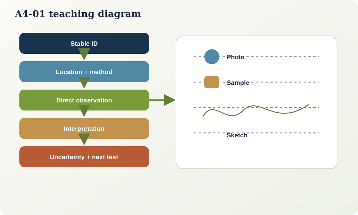
The minimum station record
A durable station record should contain the following fields.
| Field | Minimum content | Why it matters | |---|---|---| | Station identifier | Unique, stable identifier | Links map, note, photograph and sample | | Time and observer context | Date, local time if relevant, method or team role | Supports sequence and responsibility without making the record personal property | | Location | Coordinates, CRS or local-grid definition, elevation source, positional method | Allows relocation and accuracy assessment | | Observation support | Outcrop face, float, trench interval, core interval or remote image footprint | Defines what volume the statement represents | | Conditions | Weathering, wet/dry state, light, access, cover and visibility | Explains what could and could not be seen | | Description | Colour method, grain size, components, texture, structures and relationships | Preserves direct evidence | | Measurements | Value, unit, convention, instrument and repeatability note | Makes quantities interpretable | | Interpretation | Proposed unit, process, correlation or history | Keeps meaning separate from description | | Alternatives and confidence | Competing explanation, missing test and confidence basis | Prevents premature certainty | | Links | Photograph direction, sketch, sample ID and related station | Maintains provenance |
The identifier should be meaningless enough to remain stable. Do not encode a rock interpretation into the station number: if BASALT-17 is later reclassified, the identifier becomes misleading. A neutral pattern such as OR-017 remains valid.
Observation, description and interpretation
An observation is a deliberately acquired perception or instrument result. A description expresses that observation using declared vocabulary. An interpretation proposes identity, cause, continuity or history. The boundary is not always philosophically perfect, but the separation is operationally valuable.
Compare the following entries:
- Weak: “Sheared fault rock.”
- Observation: “A 0.8–1.2 m zone contains angular pale clasts in a dark fine matrix; planar fabric strikes 042° and dips 71° southeast; the eastern margin is not exposed.”
- Interpretation: “The zone may be a brittle fault breccia; a sedimentary breccia remains possible because neither margin nor displacement marker is visible.”
- Follow-up: “Trace the zone north, inspect thin section and search for offset of the marker bed.”
The second form remains useful even if the interpretation changes. The first does not reveal what justified the name.
Location is a measurement
Coordinates are not self-explanatory. Record coordinate order, units, horizontal reference, vertical reference, acquisition method and an accuracy estimate. A handheld position may be sufficient for a regional station but inadequate for a narrow contact at detailed scale. A location imported from a map click and a location measured in the field can share the same number of decimal places while having very different evidential quality.
For a local grid, record the origin, axis directions, rotation from a stated north reference, units and transformation if one exists. Never label local easting and northing as global coordinates merely because they are stored in two numeric columns.
Photographs, sketches and samples
A photograph requires station ID, time, camera direction, approximate field of view, scale object and caption. Avoid relying on automatic device metadata alone. A sketch can outperform a photograph when it selects relevant boundaries, but its exaggeration and viewpoint must be declared. Mark north, horizontal, scale and whether thicknesses are schematic.
A sample record needs a unique ID, collection location, support, purpose and relationship to the described outcrop. A loose block found downhill is float, not proof that its lithology occurs at the station. If material is removed from an interval, record which part, how much and which analyses are intended.
Worked station record
At synthetic station OR-017, a 12 m long road cut exposes interbedded sandstone and mudstone.
Direct description: beds are 30–80 mm thick; sandstone is pale grey, fine grained and forms ribs; mudstone is dark grey and recessive. A sharp planar surface through both lithologies contains polished linear grooves. The surface orientation, using the right-hand rule, is 048/67. Groove trend/plunge is 139/61. The southern two metres of the surface are obscured by soil.
Interpretation: the planar surface is provisionally interpreted as a fault because it cuts bedding and carries lineation. Sense of movement is undetermined. The hidden southern continuation is inferred, not observed.
Uncertainty: measurement repeats differ by 3° in dip direction and 2° in dip. The outcrop location is estimated within 4 m. A second observer should remeasure the surface and search for a displaced bed.
This note gives later users enough information to reject, refine or retain the fault interpretation.
Practical investigation
Choose an accessible natural or constructed exposure without collecting material. Make a ten-minute record, leave the site, then reconstruct a map symbol and description from the note alone. Audit it with these questions:
- Can the location and observation support be recovered?
- Are measurements accompanied by units and conventions?
- Which words imply process or identity rather than appearance?
- Could another reader link every photograph and sketch?
- What observation would most efficiently discriminate between interpretations?
Common failure modes
- Writing only the final unit name.
- Copying a previous map interpretation into the observation field.
- Recording coordinates without a reference system or axis order.
- Giving a photograph no direction or scale.
- Mixing float, subcrop and in-place outcrop.
- Using a clean line in a sketch for a diffuse or hidden boundary.
- Rewriting an original note after reinterpretation instead of adding a dated interpretation layer.
Mastery check
- Why should station identifiers avoid interpreted rock names?
- Rewrite “north-dipping altered volcanic” as observation plus interpretation.
- What metadata distinguish two identical coordinate pairs acquired by different methods?
- When may a sketch be more informative than a photograph?
- Which parts of OR-017 can be mapped with a solid line, and which require an uncertainty symbol?
Sources and further reading
- USGS, *Geologic Data Assistant: How Geologic Mapping Works*: https://pubs.usgs.gov/of/2004/1451/haugerud/
- USGS, *Special Session: Field Data Capture of Geologic Map Information*: https://pubs.usgs.gov/of/2001/of01-223/special.html
- OGC, *GeoSciML 4.1*: https://www.ogc.org/standards/geosciml/