B2 · Publication Volume 7
Magma Bodies and Intrusive Geometry
plutons, dykes, sills, stocks and batholiths
Learning objectives
After this lesson, you should be able to describe intrusive bodies from mapped geometry, distinguish concordant from discordant contacts, use chilled and baked margins and cross-cutting relations for relative timing, and separate observed exposure geometry from inferred three-dimensional form.
Start with a field problem
An intrusion appears roughly elliptical on a map. A narrow sheet cuts bedding on the western side, while another follows bedding near the roof. The country rock is recrystallised beside some contacts but not others. Does the map show one pluton with feeders, several events, a tilted sill, a cross-section through a dyke swarm, or an exposure surface that hides the true form?
Map shape alone is ambiguous. An inclined tabular body, vertical pipe and irregular three-dimensional pluton can all produce ellipses on one erosion surface. Geometry must be reconstructed from contact orientation, topography, cross-sections, internal fabrics, geophysics and relative-age evidence.
Core process model
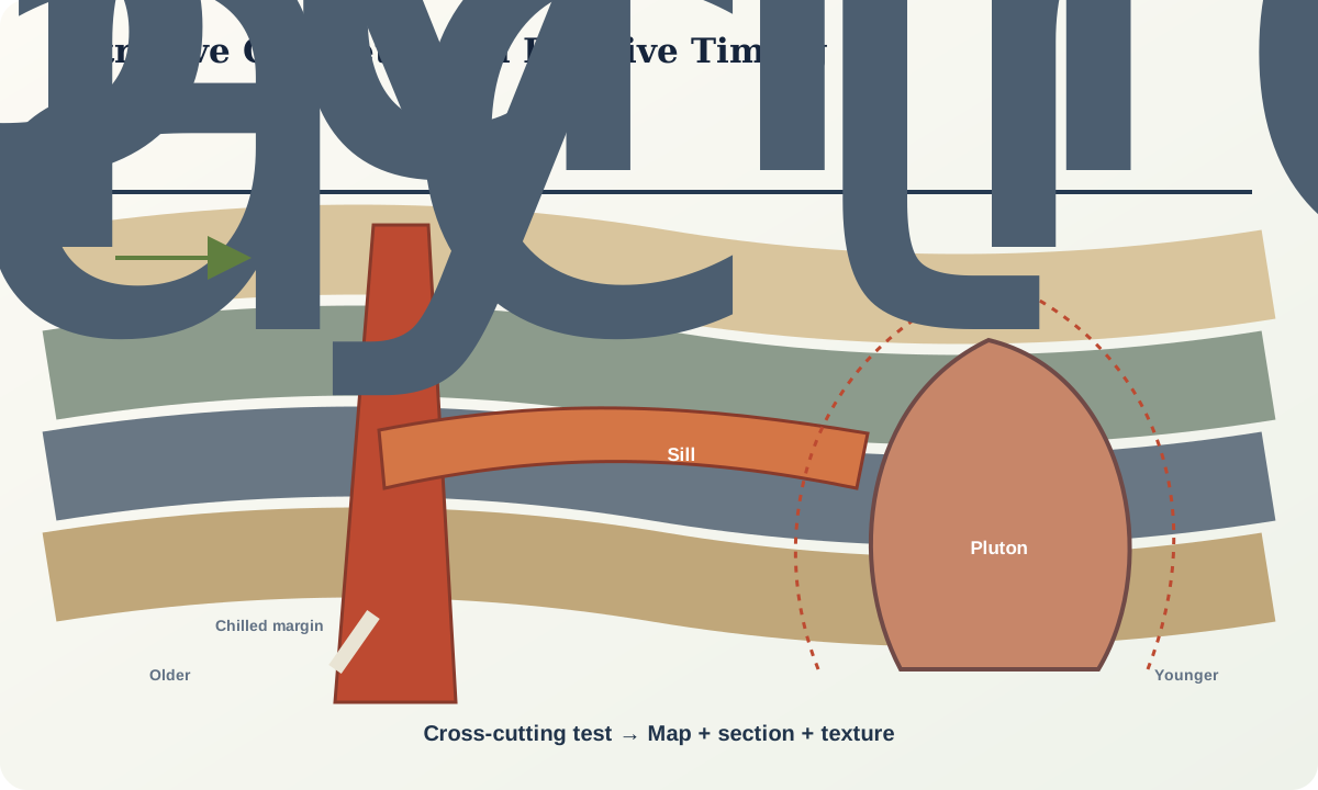
A dyke is a tabular intrusion discordant to the structure it cuts; a sill is broadly concordant. These definitions are relational, not simply vertical versus horizontal. Folding or tilting can rotate either body. A sheet can change from concordant to discordant along strike, and an apparently concordant segment may exploit a fault rather than bedding.
Terms such as stock, pluton and batholith describe bodies or mapped assemblages at different scales under stated conventions; they do not specify a single emplacement mechanism. Laccolith, lopolith and ring-dyke terms make geometrical claims that require three-dimensional evidence. Use “intrusive body” when exposure is insufficient.
Magma propagates when its pressure and buoyancy, regional stress and host-rock strength permit fracture or ductile displacement. It may inflate sheets, reuse structures, stop blocks, deform wall rock or accumulate through many pulses. A large mapped pluton need not have existed as one fully liquid chamber.
Contacts record heat and timing. A chilled margin suggests rapid cooling against cooler material, while a baked or recrystallised wall indicates heat transfer from the intrusion. Xenoliths indicate incorporation of older material but may move away from their source contact. Internal foliations and aligned crystals may record flow, compaction or later deformation and must be compared with contact geometry.
Evidence and measurement
Map both sides of a sheet where possible. Record contact strike and dip, thickness perpendicular to the walls, branching, offsets, apophyses, xenoliths, chilled zones, grain-size gradients and alteration. Distinguish true thickness from apparent width on a sloping surface:
t_{true}=w_{map}\sin\theta
only for the simplified geometry in which \theta is the angle between the sheet and the observation surface measured in the relevant plane. In real terrain, solve the three-dimensional relation and report orientation uncertainty.
Order events with redundant criteria. If dyke B cuts dyke A, B is younger at that contact. If A chills against B elsewhere, revisit mapping, because the bodies may be composite or miscorrelated. A metamorphic aureole truncated by another intrusion constrains sequence. A date from a mineral may record crystallisation, cooling or later resetting; it must not override contradictory field relations without explanation.
Geophysics can constrain concealed extent, but inversion is non-unique. Density or magnetic contrast may reflect lithology, alteration or structure. Present multiple shapes compatible with the data and show where a new observation would reduce ambiguity.
Worked example
A mapped oval is 6 km long and 3 km wide. Treating it as the horizontal section of an ellipsoid whose full vertical thickness is 1 km gives
V=\frac{4}{3}\pi abc
=\frac{4}{3}\pi(3)(1.5)(0.5)
\approx9.4\ \mathrm{km^3},
where a, b and c are semi-axes. If the same map outline is the oblique cut of a steep pipe extending 8 km, the volume and thermal history are entirely different. The ellipsoid is only one explicit hypothesis; the map area does not determine depth.
Now add observations: contacts dip outward at shallow angles, bedding arches over the roof, the centre is not exposed, and gravity data permit either a shallow lens or a deeper body with lower density contrast. “Laccolith” becomes a plausible hypothesis, not a fact. A cross-section should show both models, their assumed density contrast and the observations needed to choose between them.
Relative timing is stronger. A narrow dyke cuts both the oval body and its aureole and has chilled margins on both sides. The dyke is younger than intrusion and aureole formation, even if its numerical date has large uncertainty.
Misinterpretations and uncertainty
Vertical equals dyke and horizontal equals sill is a common error. So is assigning a batholith from one exposure, treating every inclusion as stoping evidence or reading flow direction directly from crystal alignment. Strain after crystallisation can rotate contacts and fabrics. Weathering may exaggerate weak margins, and poor exposure can make separate pulses look continuous.
Chilled margins may be absent where both magmas were hot, where later recrystallisation erased them or where the sampled contact is intrusive breccia. Contact metamorphism may be asymmetric because host composition, fluid flow, erosion level and later overprint vary.
Practical investigation
Map a synthetic 2 km square containing bedding, two sheets and one irregular body. Construct three cross-sections using the same surface traces but different dip continuations. Calculate apparent and true sheet thickness at five points. Then rank observations—contact dips, gravity, drilling, magnetic fabric, roof pendants or chilled margins—by how strongly they discriminate among the models.
Create an event table with separate columns for observed relation, inferred order, confidence and unresolved alternative. Do not place a numerical age in the sequence until you state what geological closure or crystallisation event it dates.
Mastery check
- Why can a sill be steeply dipping?
- Which observations justify a geometrical term such as laccolith?
- How can chilled and baked margins constrain relative timing?
- Why does a mapped outline not determine intrusive volume?
- What would make an internal foliation a credible magma-flow indicator?
Sources and further reading
- BGS Rock Classification Scheme, igneous material and body terminology.
- IUGS Task Group on Igneous Rocks, current task-group context and references.
- Geologic concept modelling, U.S. Geological Survey discussion of map traces, surfaces and three-dimensional rock bodies.