D3 · Publication Volume 19
Short-Term Geological Models
rapid interpretation, domains, updates and uncertainty
Learning objectives
By the end of this lesson, the learner should be able to define a short-term model's purpose and effective extent; integrate close-spaced observations without erasing long-term context; update domains and grades under operational latency; preserve alternative interpretations; validate a release; and communicate local uncertainty at the decision scale.
A short-term model is a decision-specific, time-stamped interpretation. It is not merely the long-term block model resampled into smaller cells. It may use denser recent information, different domains, a smaller extent, a more selective support and a classification rule tied to immediate material routing. These differences must be designed and recorded.
Model contract and area of validity
Define the model's purpose, consumers, spatial extent, vertical interval, effective time, input cut-off, intended selective unit, attributes, destination classes and prohibited uses. A model built for one bench or extraction panel should not silently answer a neighbouring or later decision.
Include a buffer sufficient for boundary continuity and operational context, but distinguish estimated decision area from contextual display. Mark excavated, inaccessible, not-yet-informed and out-of-scope cells explicitly. Null is a state, not a grade.
Integrating observations and prior interpretation
The long-term model supplies prior geometry, continuity and domain logic. New control drilling, faces, channels, mapping and surveys provide local conditioning evidence. Integrate them according to support and reliability. A dense but biased sample source should not automatically dominate a sparser valid source.
Maintain an observation table separate from interpreted contacts and solids. Each contact records source type, position uncertainty, observation time and confidence. Where a new observation conflicts with the prior model, document whether the change is a local adjustment, a domain reinterpretation or an unresolved scenario.
Rapid domaining without brittle geometry
Operational speed does not justify topological defects. Domains should have membership rules, contact types and priority relations. Check closure, overlaps, gaps, self-intersections, thin slivers and unintended connections. A valid solid may still be geologically implausible, so review sections in several orientations and against source observations.
Use hard boundaries when the evidence supports abrupt population separation and soft or transitional treatment when mixing or gradation is defensible. Boundary type affects estimation, classification and dilution analysis. Do not change a boundary rule merely to obtain a preferred tonnage.
Grade estimation and support
Choose an estimator and neighbourhood compatible with the local domain, data spacing and selective support. Preserve inputs and parameters. A short-term model often contains more local detail than a long-term model, but small cells do not create selective information. Validate effective sample counts, source balance, extrapolation distance and conditional bias.
When classification occurs near a cut-off, estimate the probability or sensitivity of the selective unit crossing the threshold rather than treating cell estimates as exact. Compare alternative composite lengths, boundary scenarios or estimation settings where they can materially change routing.
Change detection and significance
Compute differences only after putting model versions on compatible geometry and support. Separate cells that changed because of new samples, changed domain membership, altered estimation parameters, changed density or excavation. A global difference can hide offsetting local changes; a local percentage can explode where the reference is near zero.
Use a change map with reason codes. Summaries should report affected volume, mass, grade and contained quantity by domain and reason. A release note then explains which changes matter to upcoming decisions and which are bookkeeping or improved resolution.
Uncertainty and alternative scenarios
Local uncertainty has several components: observation position, sample quality, contact geometry, domain membership, grade variability, density and selectivity. Represent them separately when possible. A boundary corridor, probability of ore, confidence class or set of alternative solids is usually more informative than one generic confidence score.
Keep alternatives when evidence cannot discriminate. For example, a fault-adjacent lens may have a connected and a truncated scenario. Route high-consequence material conservatively or collect a discriminating observation. Do not average incompatible geometries into a surface that no hypothesis supports.
Validation and release gate
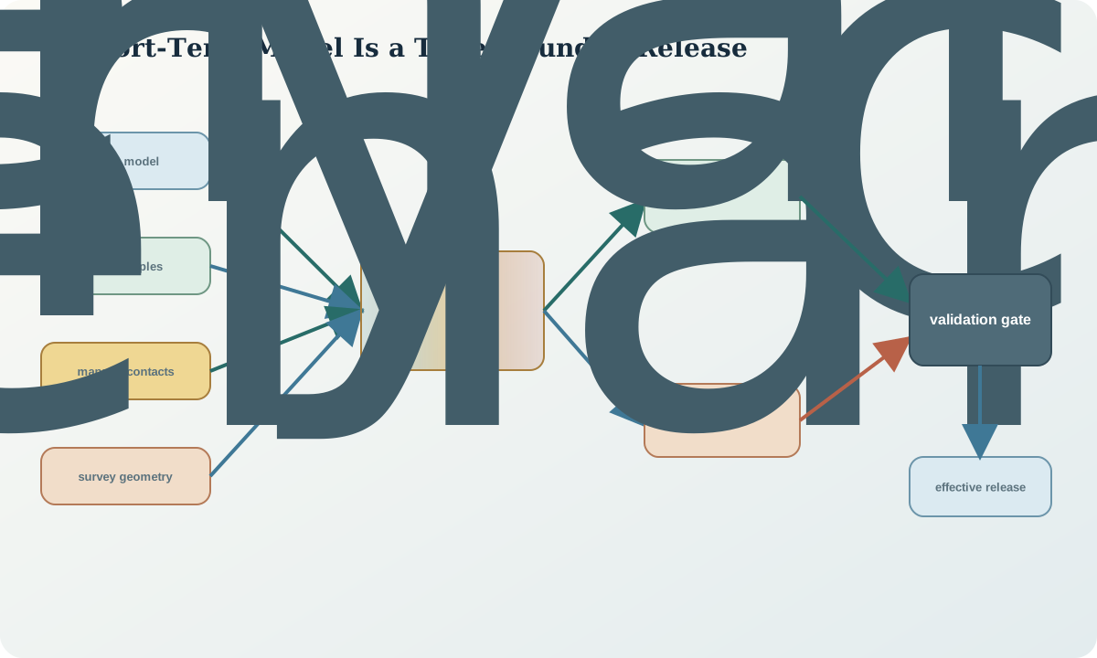
Validate input cut-off and status, geometry, domains, estimation, quantities and operability. Compare source values and estimates globally and locally; inspect boundary contacts; test volume and mass independently; check coordinate transforms; and review whether polygons or solids can be consumed by the intended downstream process.
A release gate records passed checks, exceptions, approver function, timestamp, stable identifier and predecessor. If an exception is accepted, state its spatial extent and consequence. Automated checks should fail on missing reference systems, duplicate identifiers, impossible dates, invalid solids or unbounded classifications.
Synthetic worked example
In the synthetic bench, twelve new control intervals and one mapped contact shift the eastern boundary. Scenario A connects two high-grade pods; Scenario B leaves a narrow waste septum. Both fit current observations. The decision unit cannot selectively recover the septum after blasting, so the routing sensitivity is evaluated on the recoverable parcel rather than on subcell colours.
Release ST-21 carries both scenarios, a boundary corridor and a conservative destination for three uncertain parcels. Its quantity table separates new-sample effects from changed domain membership. One parcel is held for a short channel-sampling campaign because the destination consequence exceeds the agreed uncertainty tolerance.
Practice and decision record
Write a short-term model contract and a release checklist. Given a prior surface, four new contacts and one conflicting sample, create two defensible scenarios. Map which observations discriminate between them and compare the routing decision at the actual selective support.
The record should contain input cut-off, effective extent, source and status counts, domain and estimator versions, changed-volume summary, uncertainty representation, validation results, accepted exceptions and downstream releases. State explicitly why a finer grid is not equivalent to finer knowledge.
Sources
- Mineral-resource and mineral-reserve estimation best-practice guidelines, describes model validation, support, reconciliation and comparison between long- and short-term models.
- International reporting template, 2024 edition, provides general transparency and materiality principles for geological estimates.
- Poor sampling, grade distribution and financial outcomes, illustrates support and classification consequences near a decision threshold.
- Provenance data model, supports traceable derivation, revision, invalidation and alternate entities for model releases.