D3 · Publication Volume 19
Dig Lines and Operational Communication
mark-up, coordinates, timing and version control
Learning objectives
By the end of this lesson, the learner should be able to convert an approved interpretation into an operable dig-line package; prevent coordinate, elevation and version errors; define effective and expiry times; communicate uncertainty and destination rules; verify field set-out and execution; manage revisions; and preserve evidence for later reconciliation.
A dig line is a controlled operational instruction derived from a geological and classification decision. Its purpose is to make a boundary locatable and actionable under actual visibility, access, equipment and timing conditions. A line without provenance, coordinates, status and destination semantics is only a drawing.
From model decision to released instruction
The release package should contain the source model and rule versions, bench or level, horizontal and vertical reference, three-dimensional geometry or plane, class on each side, destination mapping, control points, uncertainty zone, effective time, expiry or supersession condition and contact route for exceptions. Include a compact human-readable view and a machine-readable geometry derived from the same source.
Separate interpretation from presentation. Simplification, offsets, snapping or smoothing performed for operational use must be reproducible and quantified. If field paint or stakes represent an offset from the actual boundary, state the offset direction and distance.
Coordinate and elevation integrity
Declare coordinate reference, axis order, units, grid convergence where relevant, elevation datum and bench or level convention. Easting and northing swaps, feet–metres confusion, local-grid transforms and sign errors can produce plausible-looking but dangerous displacement. Do not rely on a file extension or display background to establish reference.
Validate with independent control points whose coordinates and physical identity are known. Check transform direction and residuals. A line exported to a device should return to the controlled environment and overlay its source within tolerance. Record any device-specific rounding or vertical handling.
Geometry and operability checks
Check closed polygons, non-self-intersection, no unintended gaps or overlaps, minimum segment and island rules, accessible set-out points and consistency with current excavation. The geometry should distinguish ore, waste, marginal, isolation and no-dig states rather than encoding meaning only by colour.
Review the line from the operator's direction of approach. A mathematically valid polygon may be ambiguous behind a face, beneath broken material or across multiple elevations. Add chainage, labelled vertices, arrows or bounded zones where they reduce ambiguity. Safety and geotechnical controls remain separate authoritative constraints and must not be inferred from a grade-control line.
Time validity and late information
Every instruction needs a valid-from time and a rule for expiry. Model updates, new assays, surveyed progress, blast movement or changed destination capacity can invalidate it. A static screenshot can survive after its source has been superseded, so the visible version and status must be prominent.
If new information arrives during execution, decide whether to stop, finish a bounded parcel, isolate material or issue a controlled revision. Record which loads occurred under each version. Retrospective edits to the original line destroy the ability to evaluate what was communicated.
Destination semantics and material classes
Class labels must map to controlled destination identifiers and state any conditional rule. “Ore” may be insufficient if different blend, processing, stockpile or isolation classes exist. Define fallback destination when the intended one is unavailable, and require an event when a dispatcher changes destination.
Keep quality prediction separate from routing class. A polygon may carry predicted mass, grade, confidence and material characteristics, but the operational instruction must state which attributes control routing. A later threshold change should generate a new classification version, not silently recolour the old geometry.
Communication loop and acknowledgement
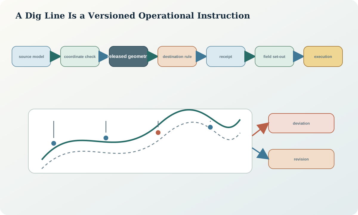
Communication is closed-loop: release, receipt, comprehension, field set-out, execution observation and exception feedback. An acknowledgement confirms the receiver obtained the current version; it does not prove comprehension or correct set-out. Use a brief confirmation of bench, version, class sides and control point.
Changes should reach every active consumer, including printed maps, mobile devices, dispatch logic and field markings. Maintain a distribution list by function or system, not by assumed personal knowledge. Withdraw superseded artefacts where possible and mark retained copies clearly.
Field verification and deviation capture
Verify selected vertices or segments against independent spatial control. Record set-out method, instrument status, observation time and achieved residual. During extraction, capture visibility, material condition, boundary exposure, deviations, unexpected geology and the actual stopping line. A georeferenced note or sketch is more useful than an unlocated comment.
Classify deviations: authorised operational adjustment, unavoidable access deviation, interpretation mismatch, set-out error, execution error or unrecorded change. The category is provisional until evidence is reviewed. Avoid converting every model–actual difference into an execution fault.
Revision, exception and incident control
A revision should identify predecessor, changed geometry or semantics, reason, effective time and affected unexecuted material. An exception records a bounded departure without rewriting the general rule. An incident records a control failure or consequence requiring a separate response. These objects may be linked but should not be conflated.
Use a pre-release checklist and a rapid revision path. Speed comes from prepared controls, not from omitting them. High-consequence ambiguity should trigger a pause or isolation rule already defined in the communication protocol.
Synthetic worked example and practice
Synthetic release DL-52 is derived from ST-24 for bench B-17. A tablet import interprets the local grid as a projected grid and shifts the line by 6.4 m. The return-overlay control catches the displacement before set-out. Later, two control assays move one segment by 2.1 m; DL-53 becomes effective at 14:20, after six loads were completed under DL-52.
Build the release package, coordinate-control sheet and acknowledgement. Partition movement events by active version and compare actual excavation with the appropriate line. Record the first error as a prevented coordinate incident and the later change as new-information revision, not as one generic dig-line variance.
Sources
- Survey plans for mines, provides a public example of spatial-control, plan currency and survey-record expectations.
- Reconciliation along the mining value chain, links grade-control plans, delineation, loading, dispatch and audit trails.
- Provenance data model, supports version, derivation, invalidation and activity records for controlled releases.
- Mineral-resource and mineral-reserve estimation best-practice guidelines, provides general expectations for spatial consistency, model validation and documented procedures.