F1 · Publication Volume 30
Tenure, CRS and Spatial Control
tenure, coordinates, vertical datum, mine grid and extent validation
Learning objectives and boundary
- Explain tenure, coordinates, vertical datum, mine grid and extent validation as an auditable evidence problem.
- Separate source observations, controlled derivatives, interpretation and decision state.
- Apply identity, spatial, semantic, lineage, quality and review checks.
- Produce a spatial-control register, transformation ledger and reproducible validation report.
This lesson is part of a general, institution-neutral tutorial and has no relationship to any company or individual. All identifiers, geometries and values in the worked case are explicitly synthetic. The method does not confer professional authority and must not be transferred to a real decision without appropriate sources, competence, law and review.
Core method
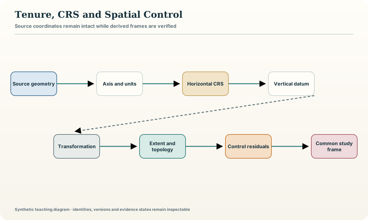
Spatial control begins by preserving source coordinates exactly as received. Store the coordinate reference system identifier, axis order, units, epoch where relevant, vertical datum, transformation method and accuracy statement. A feature without a resolvable CRS is not repaired by visually aligning it. Keep transformed coordinates as derived values linked to the source geometry and transformation record.
Tenure-like boundaries in SYN-WB are wholly fictitious teaching geometries. They demonstrate topology, version and date control; they do not describe rights. Validate rings, self-intersections, gaps, overlaps, extent, expected region, transformation direction and vertical sign. A local grid is an explicit transformation with origin, rotation, scale and handedness, not a renamed projected grid. Test control points and round trips before any overlay or distance is interpreted.
Record and evidence model
| Field or object | Operational meaning | |---|---| | geometry_source | untouched source coordinates and declared axis order | | crs_id, epoch and vertical_datum | complete reference frame | | operation_id and parameters | selected transformation and settings | | accuracy and area_of_use | stated uncertainty and validity domain | | control_residual and round_trip | measured verification evidence |
Every record carries a version, validity interval, source or derivation link, quality state and review state. Missing, unknown, not applicable and failed are separate states; none is silently represented as zero or an empty string.
Controlled workflow
- Inventory every horizontal and vertical reference frame.
- Preserve source coordinates and resolve axis order and units.
- Select a valid transformation for the study area and epoch.
- Validate extents, topology, control points and vertical sign.
- Store transformed derivatives with full operation provenance.
- Block overlays whose spatial identity or residual exceeds the charter.
Record each step as an activity with declared inputs, parameters, outputs and checks. A rerun creates the same content or a documented difference; it never overwrites the evidence needed to explain the previous state.
Worked synthetic example
A synthetic collar file arrives in longitude–latitude order while a fictitious boundary layer declares latitude–longitude axes. Their numeric ranges look plausible in either order. Extent tests and three synthetic control points expose the swap. The corrected workflow keeps both originals, records the axis normalization and transformation, and obtains a maximum round-trip residual of 0.012 m against a charter tolerance of 0.05 m.
The example is deliberately small enough to inspect row by row. Its names and numbers are fictional teaching values and cannot be used to infer a real place, right, resource, hazard or organisation.
Quality control and failure modes
Run six gates before accepting the lesson artefact: identity resolves the exact objects; spatial control confirms coordinate and extent validity; semantics preserve units, vocabularies and epistemic class; lineage exposes every transformation and dependency; quality records passed, failed and not-run checks; review binds a disposition to the exact content digest. A failed gate is retained as evidence and blocks only the affected use. It is never converted into a favourable value or hidden to simplify the display.
Common failure modes:
- Inferring a CRS from plausible coordinates
- Overwriting source coordinates after transformation
- Ignoring vertical datum and sign
- Calling a local grid a CRS without parameters
- Accepting visual coincidence instead of control residuals
Practical exercise
Complete the following tasks against a new copy of the synthetic package:
- Diagnose an axis-order ambiguity.
- Write a complete local-grid transform record.
- Design extent and round-trip tests.
- Explain why a valid transform may still be unsuitable outside its area of use.
For every answer, cite the package object IDs, show the failed as well as passed checks, and state which conclusion would change if one assumption were reversed.
Completion artefact and verification
Deliver a spatial-control register, transformation ledger and reproducible validation report. Include a manifest, exact input identities, transformation or reasoning record, machine-readable validation results, human-readable limitations and the current review state. A second reader must be able to trace one accepted conclusion to its source support, one rejected path to its first failed gate and one unknown to the evidence required to resolve it. Rebuild the artefact from a clean location and compare content digests. Completion is withheld when a required source, parameter, permission or review is missing; no substitute data are invented.
Sources
- EPSG coordinate reference system registry, a maintained registry of coordinate reference systems, datums and transformations.
- Open geospatial standards catalogue, the authoritative catalogue of open geospatial implementation standards.
- The GeoJSON Format, RFC 7946, the normative syntax and coordinate rules for interoperable GeoJSON objects.