C5 · Publication Volume 15
Image Geometry and Preprocessing
orthorectification, atmospheric correction and co-registration
Learning goals
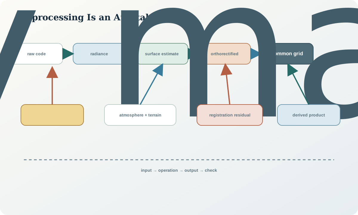
This lesson makes preprocessing an auditable physical model rather than a button sequence. The learner should be able to distinguish radiometric calibration, top-of-atmosphere and surface quantities; explain orthorectification and relief displacement; evaluate atmospheric and topographic correction; measure co-registration; choose resampling by data type; and preserve masks and processing lineage.
Preprocessing should make observations comparable only to the degree justified by its inputs and assumptions. Every correction can leave residual error or introduce correlation. A “corrected” label is not a quality certificate.
Sensor geometry and orthorectification
Raw image geometry is controlled by detector layout, scan timing, platform position and attitude, viewing direction, Earth shape and terrain. Relief displaces elevated and depressed surfaces away from their map positions in a perspective image. Orthorectification uses a sensor model, control and elevation data to map samples onto a declared coordinate system.
Geometric accuracy has absolute and relative components. Absolute accuracy compares image position with ground reference. Relative or co-registration accuracy compares images with each other. A product adequate for regional mapping may still be inadequate for pixel-level change. Terrain-model error, control distribution, cloud-obscured tie points and sensor-model limitations can create spatially varying residuals.
Inspect check points independent of those used in correction. Report error vectors and robust summaries, not only one global root-mean-square value. Examine mountains, edges of scenes and areas with few tie points separately.
Radiometric and atmospheric processing
Radiometric calibration converts instrument codes to radiance or another calibrated quantity using metadata. Solar-reflected top-of-atmosphere reflectance reduces some illumination and distance effects but still includes atmosphere. Surface-reflectance processing estimates a surface-related quantity by modelling scattering and absorption with auxiliary information such as aerosol, water vapour, pressure and geometry.
Atmospheric correction is ill-conditioned over dark, bright, high, heterogeneous or cloud-adjacent surfaces when model inputs are weak. Thin cloud and haze can survive cloud masks. Adjacency effect transfers radiance from nearby bright targets into a pixel. A product can be numerically valid yet unsuitable for a subtle absorption or change decision.
Preserve radiance or top-of-atmosphere inputs alongside surface products. Record algorithm, version, auxiliary data and per-pixel quality. Compare stable surfaces across scenes and inspect residual dependence on aerosol, view angle and elevation.
Topographic illumination and bidirectional effects
Slope and aspect change incident illumination and viewing geometry. A north-facing and south-facing exposure of the same material may have different brightness, shadow and scattering. Simple cosine correction can overcorrect poorly illuminated slopes and assumes a surface response that may not hold. Empirical or semi-empirical corrections also require stable reference assumptions.
Bidirectional reflectance means surface response varies with illumination and view directions, particle structure and roughness. Time series that mix view geometry can show changes unrelated to material. Normalisation can improve comparability but adds model dependence. Keep geometry fields and correction coefficients with the output.
Never use corrected shaded pixels automatically. Low incoming energy produces low signal and unstable ratios even if a formula raises brightness. Maintain a terrain-shadow or low-illumination mask and communicate lost support.
Co-registration and resampling
Co-registration aligns observations to a common grid. Estimate subpixel offsets with stable, well-distributed features; avoid cloud, moving vegetation, water and changed surfaces. A single translation may be inadequate when residual rotation, shear, terrain parallax or local warp exists. Validate on held-out tie points and map residual vectors.
Resampling assigns values to the output grid. Nearest neighbour preserves original codes and categorical masks but creates block structure. Bilinear and cubic methods smooth continuous fields and introduce new values. Area-weighted aggregation can conserve averages when grids are nested appropriately. Downsampling needs an anti-aliasing strategy; upsampling does not add resolution.
Apply the same spatial transform consistently but resample science bands, uncertainties and categorical masks with methods appropriate to each. Record grid origin, pixel alignment, coordinate reference, transform and kernel. One half-pixel convention error can mimic a boundary shift.
Quality assurance and uncertainty propagation
Build a preprocessing ledger with input checksums, product identifiers, calibration coefficients, masks, auxiliary atmosphere and elevation sources, geometric transform, resampling method, output scale, software-independent equations and diagnostic metrics. Preserve pre- and post-correction histograms and stable-target comparisons.
Uncertainty includes calibration error, atmospheric residual, terrain correction, geolocation and resampling covariance. For a band ratio q=x/y, first-order variance includes uncertainty in both bands and their covariance. Treating resampled neighbouring pixels as independent overstates effective sample size.
Define failure actions before processing: reject scenes with insufficient control, retain top-of-atmosphere values when surface correction is unstable, mask rather than fill saturated or cloud-contaminated pixels, and widen change thresholds where registration uncertainty is high.
Worked synthetic example
Two synthetic 20 m scenes contain a sharp geological boundary and a narrow road. Scene B is shifted by 0.35 pixel east and 0.20 pixel north. Differencing without alignment creates paired positive and negative bands along both features. A translation estimated from stable control reduces the road residual, but a terrain-dependent offset remains on a steep ridge because the orthorectification used an incorrect elevation surface.
The mean offset is small, yet the local residual exceeds the width of the change target. The correct decision is to exclude the ridge from pixel-level change, repair geometry with an appropriate elevation model and retain the exclusion mask. Raising a change threshold would hide the symptom without correcting the location error.
Interpretation and decision.
Preprocessing creates an analysis-ready claim, not ground truth. State the quantity after each step: calibrated radiance, top-of-atmosphere reflectance, estimated surface reflectance, terrain-normalised reflectance or resampled grid. Avoid mixing products at different levels in one ratio or time series unless the transformation is justified.
Use residual diagnostics to set the smallest defensible mapping or change unit. Where atmosphere, terrain or geometry is unreliable, report unknown rather than forcing a class. A defensible map shows excluded support and links it to the reason.
Practice and audit checklist
Given two synthetic scenes and metadata, reconstruct scale and offset, build cloud and saturation masks, estimate co-registration from stable controls and choose resampling for reflectance and categorical masks. Produce before/after difference images and a residual-vector map. Document where correction remains inadequate.
Audit questions: Are input processing levels compatible? Is the vertical datum of the elevation model known? Are independent check points used? Are atmosphere and terrain parameters recorded? Are masks resampled categorically? Is subpixel registration adequate for the claimed change? Can every output pixel be traced to its source?
Sources
- Collection-level geometric and radiometric improvements, documents calibration, control and product-format changes in a long remote-sensing archive.
- Level-1 geometry tiers and registration criteria, explains terrain correction, geometric quality and time-series suitability.
- Surface-reflectance processing and caveats, describes atmosphere-corrected products, scaling and auxiliary quality information.
- Cross-sensor orthorectified co-registration assessment, provides a primary evaluation of relative geometric accuracy.