B1 · Publication Volume 6
Continental Depositional Environments
alluvial, fluvial, aeolian, lacustrine and glacial systems
Learning objectives
After this lesson, you should be able to compare major continental process domains, link facies associations to water, wind, ice and gravity, recognise transitions and reworking, and construct multiple environmental hypotheses from incomplete terrestrial records.
Start with a field problem
A succession contains matrix-supported conglomerate, cross-bedded sandstone, red mudstone with root traces, well-sorted sand with large inclined sets, laminated dark mud and a diamictite. It is tempting to assign one environment to each bed and stop. A more useful question is how these deposits relate in space and time.
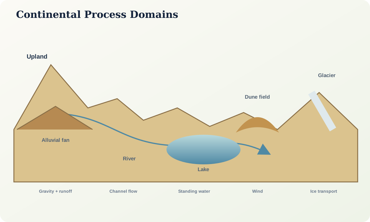
An alluvial fan can feed a river; wind can rework exposed channel sand; a lake can expand across a floodplain; ice can deliver poorly sorted debris into a lake; slope failures can interrupt any of these settings. Continental basins are mosaics whose boundaries migrate with climate, relief, tectonics, water balance, vegetation and sediment supply.
Core process model
Alluvial systems transfer sediment from confined uplands to lower-gradient basins. Debris flows, sheetfloods, channelised flows and soil formation can coexist. Fan shape alone does not identify the depositing process. Proximal-to-distal trends may be interrupted by faulting, avulsion or source change.
Fluvial systems include channels, bars, levees, splays, flood basins and abandoned courses. Channel pattern is a response to discharge variability, slope, sediment calibre, bank strength, vegetation and valley confinement. Rock records rarely preserve a complete planform, so use architectural elements and bounding surfaces rather than forcing a modern channel label.
Aeolian systems transport sediment by wind. Dunes can form large cross-sets, while interdunes preserve deflation surfaces, damp deposits, evaporites or soils. Wind-ripple lamination, grain-surface textures and high sorting can support interpretation, but large cross-beds also form under water.
Lacustrine systems respond sensitively to water balance and basin geometry. Marginal deltas, beaches, evaporative flats, profundal muds and mass-flow deposits may occur within one lake. Varve-like lamination requires evidence for periodicity; counting couplets without testing origin is unsafe.
Glacial systems involve erosion, direct ice deposition, meltwater transport, lakes and marine interaction. A diamictite is a descriptive, poorly sorted deposit; it is not automatically a till. Clast fabric, striation, deformation, associated outwash and regional context are needed.
Evidence and measurement
Build a facies table before naming environments. Record lithology, texture, support, grading, structures, fossils or traces, colour with weathering state, palaeoflow and bounding surfaces. Map lateral relationships and unit geometry. Identify evidence for subaerial exposure, standing water, channel confinement, wind transport, ice contact and mass movement.
Use scale explicitly. A centimetre mud drape, metre channel fill, kilometre fan lobe and basin-wide lake expansion are different objects. Apparent cyclicity depends on sampling interval and exposure length. Remote imagery can show planform geometry, but subsurface architecture and age relationships remain hypotheses until constrained.
Worked example
Consider a fining-upward package with an erosional conglomeratic base, cross-bedded sandstone, ripple-laminated fine sand and rooted mudstone. A migrating river channel followed by abandonment and floodplain development is plausible. A distributary channel in a lake-margin delta could create a similar vertical trend.
Discriminating evidence includes the scale and geometry of the channel body, abundance and type of marine or freshwater fossils, regional palaeoslope, associated mouth bars, wave or tidal structures, palaeosols and the distribution of coeval mud. If no fossils are preserved, absence cannot be treated as proof of a terrestrial setting.
Now place a later, well-sorted large-set sandstone above an erosion surface. Aeolian reworking is plausible if grainfall and wind-ripple lamination, interdune surfaces and consistent three-dimensional dune geometry occur. Large cross-set size alone is insufficient.
Misinterpretations and uncertainty
Red colour is not a climate gauge by itself; oxidation can be early or late. Coal does not uniquely define a humid swamp, because transport and preservation matter. Poor sorting is not unique to glaciers. Large cross-beds are not unique to deserts. Fine lamination is not automatically annual.
Modern analogues help reveal processes but can mislead when basin size, vegetation, atmospheric density, sediment type or preservation differs. Use analogues to generate measurable predictions, not to transfer a landscape photograph directly into deep time.
Practical investigation
Create two environment maps for the same synthetic section set. Model A should emphasise a river–floodplain–lake system; Model B should emphasise an alluvial-fan–playa–aeolian system. For every mapped boundary, list the facies association and directional evidence. Rank five observations that would most efficiently choose between the models.
Mastery check
- Why is a diamictite not automatically a glacial till?
- Which variables influence fluvial architecture besides discharge?
- How can aeolian and subaqueous cross-beds be discriminated?
- Why can a lake record abrupt lateral and vertical changes?
- What makes an analogue testable rather than merely similar-looking?
Sources and further reading
- Glaciers and icecaps, U.S. Geological Survey.
- Lakes and reservoirs, U.S. Geological Survey.