B1 · Publication Volume 6
Introduction to Sequence Stratigraphy
accommodation, base level, systems tracts and scale
Learning objectives
After this lesson, you should be able to define accommodation, relative base level and shoreline trajectory, distinguish stacking patterns from their causes, identify candidate sequence-stratigraphic surfaces, and apply systems-tract terminology only after declaring model, scale and evidence.
Start with a field problem
A set of coastal clinoforms shifts basinward, then aggrades, then steps landward across a widespread mudstone. Is this a sea-level cycle? It may be, but sediment supply, subsidence, compaction, inherited topography, channel avulsion and observation scale can produce similar trajectories.
Sequence stratigraphy is most useful when it organises surfaces, facies and geometry into testable histories of accommodation and sediment transfer. It becomes unreliable when a standard curve is imposed before the data are described.
Core process model
Accommodation is the space available for sediment accumulation relative to a chosen datum and depositional surface. It is created or destroyed by relative water-level change, subsidence, uplift, compaction and inherited relief. Accommodation is not identical to water depth: sediment can fill space as rapidly as it forms.
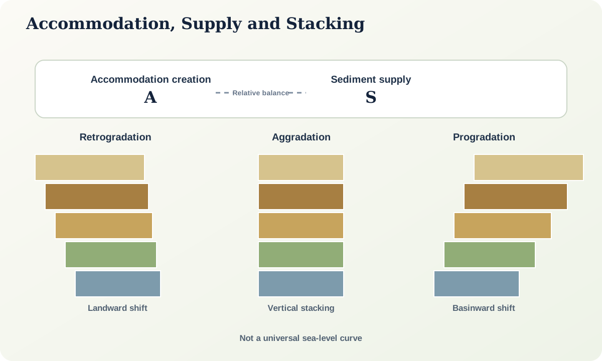
Sediment supply is the rate and calibre of material delivered to a location. The ratio and spatial distribution of accommodation creation to supply influence stacking. When accommodation outpaces supply near a shoreline, facies may shift landward and stack retrogradationally. When rates are broadly balanced, aggradation may dominate. When supply outpaces available space, deposits can prograde basinward. These are tendencies, not equations with universal thresholds.
Base level is a conceptual surface controlling long-term erosion and deposition within a system. Relative sea level is important in marine-connected basins but is not the only control. Upstream profiles, lake levels, tectonic thresholds and local sills can matter.
Candidate surfaces include subaerial unconformities, their correlative marine surfaces, flooding surfaces and maximum-flooding intervals. Their expression changes laterally and may be diachronous at the resolution of interest.
Evidence and measurement
Identify stacking from observed facies trajectories and stratal geometry before naming systems tracts. Map onlap, downlap, truncation, toplap, channel incision and condensation with data resolution stated. Tie core and logs to geophysical surfaces where possible. Record whether a surface is directly observed, interpolated or model-derived.
Systems-tract names depend on a chosen sequence model and surface hierarchy. Declare the model rather than mixing terms from incompatible schemes. At small scale, autocyclic channel or lobe switching can mimic sequence-scale trends. At large scale, several higher-frequency cycles can merge below resolution.
Age control tests synchronicity and rates. An apparently sharp regional surface can take substantial time to form and migrate. Construct age-depth envelopes rather than one deterministic line.
Worked example
Three logs show basinward-stepping shoreface sandstone capped by a laterally extensive offshore mud, followed by landward-stepping coastal facies. Interpretation A invokes progradation during stable or slowly rising relative level, rapid flooding, and retrogradation during faster rise. Interpretation B invokes increasing sediment supply, abrupt channel abandonment, and redistribution to another lobe without major regional water-level change.
Discriminators include regional extent of the flooding surface, evidence of subaerial erosion landward, age equivalence across lobes, sediment-volume change, subsidence pattern and independent palaeogeographic data. A global curve cannot decide between them without a local age and subsidence model.
Misinterpretations and uncertainty
Do not label every erosional contact a sequence boundary. Channels erode within many systems tracts. Do not label the muddiest bed maximum flooding without testing condensation, extent and trajectory. Do not infer eustasy directly from one basin.
Vertical logs can show stacking but not uniquely reveal shoreline direction. Seismic termination depends on imaging and processing. Compaction changes thickness and accommodation retrospectively. Scale hierarchy must be explicit; a “sequence” at one resolution may be a bedset at another.
Practical investigation
Given a synthetic cross-section, first annotate only observed terminations, facies shifts and surfaces. Create two accommodation–supply histories that explain them. Only then choose and declare a sequence model, name candidate surfaces and assign systems tracts. Mark every assignment whose evidence would change under the alternative history.
Mastery check
- Why is accommodation not the same as water depth?
- What observations define retrogradation before its cause is interpreted?
- How can supply change mimic a relative water-level signal?
- Why may a flooding surface be diachronous?
- What must be declared before systems-tract terminology is auditable?
Sources and further reading
- Towards the standardization of sequence stratigraphy, Earth-Science Reviews.
- International Stratigraphic Guide, International Commission on Stratigraphy.